Geospatial Technology

AnatopAI

AnatopAI Advanced Annotation Services for the Geospatial Technology Industry

Welcome to AnatopAI, your trusted partner in providing state-of-the-art annotation services for the Geospatial Technology industry. With our expertise and precision-driven approach, we offer accurate and reliable annotations that fuel the development of innovative AI models and solutions in the geospatial domain. Discover how our industry-specific annotation services can enhance your geospatial projects and unlock the full potential of your data

Our Annotation Services for the Geospatial Technology Industry:

Satellite Image Annotation

Satellite imagery plays a crucial role in various geospatial applications, including mapping, environmental monitoring, and urban planning. AnatopAI specializes in satellite image annotation services, providing precise annotations for object detection, land cover classification, and change detection. Our annotations enable the development of AI models that extract valuable insights from satellite imagery, empowering effective decision-making and resource management.

Object Detection in Aerial Imagery

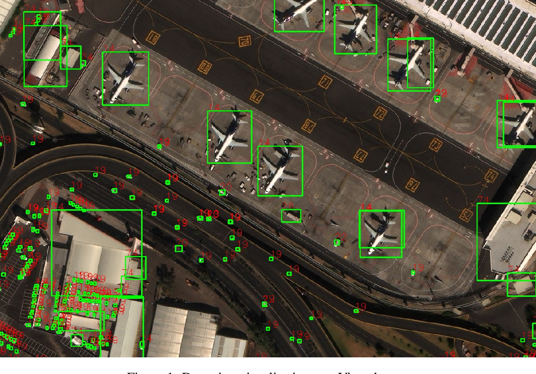
Aerial imagery provides valuable insights for agriculture, environmental monitoring, and infrastructure development. AnatopAI excels in object detection annotation services for aerial imagery, enabling the identification and classification of objects such as buildings, vehicles, vegetation, and water bodies. Our annotations support accurate mapping, change detection, and asset management in the geospatial industry.

LiDAR Point Cloud Annotation

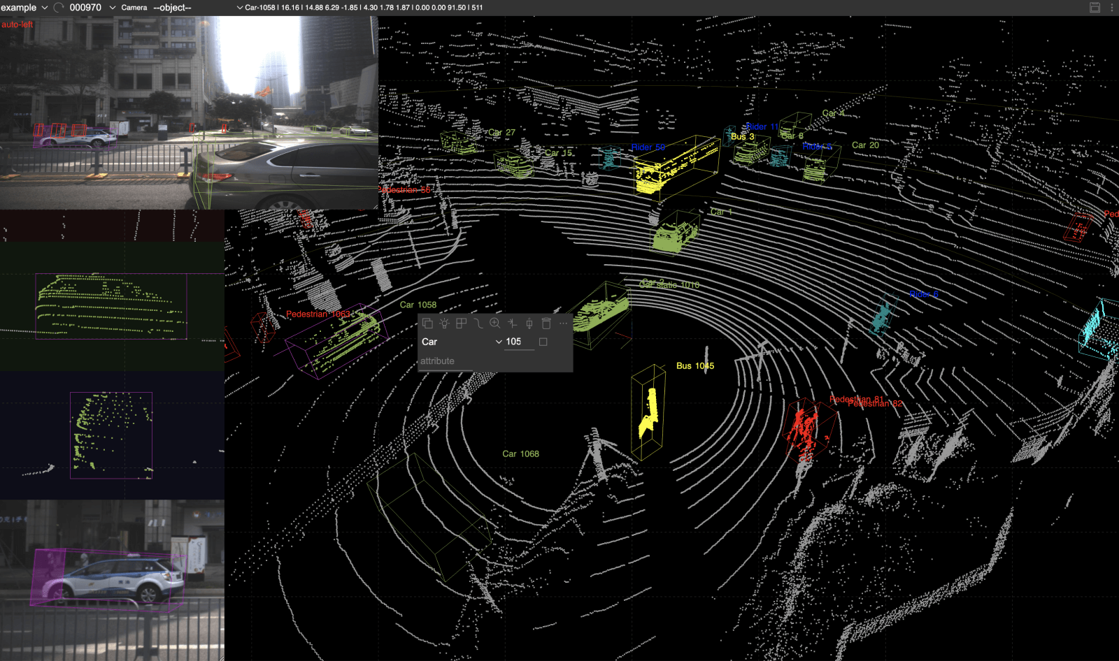
LiDAR technology captures detailed 3D point cloud data that is essential for geospatial analysis, terrain modeling, and infrastructure planning. AnatopAI offers accurate LiDAR point cloud annotation services, meticulously annotating ground points, buildings, vegetation, roads, and other features. Our annotations enable the creation of high-resolution 3D models and facilitate precise geospatial measurements and analysis.

Why Choose AnatopAI for Geospatial Technology Annotation Services?

Industry Expertise

We have a deep understanding of the geospatial technology industry and its unique requirements. Our team of experienced annotators ensures that the annotations align with industry standards and specific geospatial applications.

Quality Assurance

We adhere to stringent quality control measures to ensure the accuracy and reliability of our annotations. Our dedicated quality assurance team performs thorough checks to meet your project's desired quality standards.

Data Security

We prioritize the security and confidentiality of your geospatial data. Our robust data protection measures and secure infrastructure ensure that your sensitive information remains protected throughout the annotation process. Scalability and Timeliness: With our scalable infrastructure and efficient annotation processes, we can handle projects of any size and deliver annotations within your desired timeframe.

Customized Solutions

We understand that each geospatial project is unique. We offer tailored annotation solutions to meet your specific data requirements, ensuring that our annotations contribute directly to your project's success.